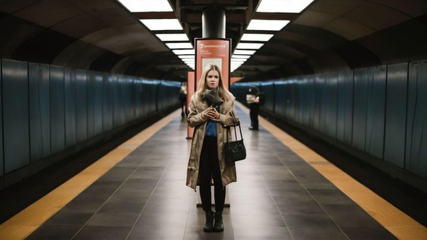
New York looks different when experienced at running speed, and Kanat Sultanbekov provides a useful context for considering what becomes visible when the city is explored on foot. Subway trips can make neighborhoods feel like isolated stops, while cars often move too quickly to notice smaller details. Running fills in the spaces between destinations, revealing how streets, parks, businesses, infrastructure, and neighborhoods actually connect.
Running is primarily exercise, but in a dense city, it can also become an unusually effective way to understand the environment at street level.
Running changes the perceived scale of New York.
Transportation affects how people mentally organize a city.
Someone who primarily uses the subway may think about New York through stations and train lines. A journey begins at one stop and ends at another, while much of the physical space between those locations disappears underground.
Running restores that missing geography.
Moving several miles above ground reveals how one neighborhood gradually becomes another. Building styles change, commercial corridors give way to residential streets, pedestrian traffic shifts, and familiar landmarks appear from unexpected directions.
Places that once seemed separate can suddenly feel closely connected.
Neighborhood Boundaries Become Less Obvious
Neighborhood names create useful identities, but actual transitions are rarely marked by precise boundaries.
Running makes this particularly noticeable.
A route may begin among busy commercial streets before gradually entering quieter residential blocks. Restaurants and storefronts change. Architecture shifts. Parks or major avenues can create natural transitions between different areas.
These changes show that neighborhoods are not isolated pieces of the city. They overlap and influence one another.
Experiencing those transitions on foot provides a perspective that is difficult to gain when traveling underground from one named destination to another.
Street Design Becomes Impossible to Ignore
A route that looks straightforward on a map may feel entirely different once someone runs it.
Sidewalk width, traffic signals, construction, intersections, pedestrian congestion, and road design immediately become relevant.
Runners quickly notice details such as the following:
- Sidewalk conditions
- Busy intersections
- Traffic volume
- Pedestrian congestion
- Construction detours
- Lighting
- Access to parks
- Continuity between paths
These characteristics affect more than exercise. They also influence residents walking to work, families using strollers, people running errands, and anyone navigating the neighborhood without a vehicle.
A street can be geographically convenient while still being frustrating to use.
Parks Become Routes, Not Just Destinations
Parks are commonly viewed as places people visit for recreation. For runners, they can also become important connections through the city.
A park path may provide a continuous route that avoids frequent traffic signals and congested sidewalks. Greenways and waterfront paths can connect neighborhoods while offering a different experience from nearby streets.
This highlights an important distinction between distance and usability.
The shortest route is not always the most practical. A slightly longer path through a park may feel faster or easier because movement is less frequently interrupted.
For runners, these alternatives gradually become part of a personal map of the city.
Waterfronts Reveal Another Side of Urban Life
New York’s waterfronts can feel surprisingly distant from everyday life when routine travel occurs mainly by subway or along major streets.
Running can change that perspective.
Waterfront routes reveal parks, piers, bridges, recreational areas, and views that are easy to miss during an ordinary commute. They also demonstrate how public access can transform the edge of a city from a geographic boundary into an active community space.
A waterfront can simultaneously accommodate runners, cyclists, walkers, families, and people simply spending time outdoors.
These spaces show how thoughtful public infrastructure can create opportunities for both movement and recreation within a dense urban environment.
Small Infrastructure Details Become More Visible
Major bridges, tunnels, roads, and transit systems receive considerable attention, but smaller infrastructure decisions also shape everyday city life.
A well-positioned crossing can make a route easier. A poorly designed intersection can interrupt movement. Construction can redirect pedestrians for months. A connected pathway can make two areas feel significantly closer.
These details may seem minor individually, but their effects accumulate through repeated daily use.
Running makes them difficult to overlook because each design choice directly affects movement.
The experience provides a practical reminder that infrastructure is not only about major projects. It is also about the countless smaller systems that determine how comfortably people move through a city.
Local Businesses Become Easier to Discover
Routine transportation can create narrow patterns.
Someone may leave home, enter the same subway station, emerge near work, and repeat that journey almost every day. Restaurants, cafés, stores, and parks located only a few blocks outside that pattern may remain unnoticed.
Running encourages a wider view.
Changing a route by several streets can reveal independent restaurants, neighborhood markets, small parks, or commercial areas that would otherwise be easy to miss.
These discoveries help create a more detailed understanding of a neighborhood.
Instead of knowing an area only through a station or major avenue, runners can begin recognizing the smaller destinations that contribute to local character.
The Same Route Changes Throughout the Day
New York streets do not have one fixed personality.
An early-morning run might encounter delivery vehicles, dog walkers, commuters, and other people exercising. The same streets in the evening may be filled with restaurant customers, shoppers, and people returning home.
Weekends create another pattern.
Observing these changes makes it clear that neighborhood identity depends partly on time. An area that appears quiet during one visit may be highly active several hours later.
Regular running provides repeated exposure to these different rhythms.
This can create a more realistic impression of how neighborhoods function throughout the week rather than how they appear during a single moment.
Subway Maps Can Distort Distance
Public transportation maps are designed to explain transit systems, not actual geography.
As a result, they can influence how people perceive distance.
Two neighborhoods may seem far apart because traveling between them requires a transfer. At street level, they might be separated by a relatively simple run or walk.
The opposite can also happen. Two subway stops that appear close may involve a more complicated above-ground route than expected.
Running gradually replaces this transit-based understanding with a physical sense of direction and distance.
Over time, streets begin connecting in ways that make the broader city easier to understand.
Running Creates Exploration Without Requiring a Destination
Most city travel has a specific objective.
People travel to work, restaurants, appointments, stores, or social events. The goal is usually to reach the destination efficiently.
Running is different because movement itself is the purpose.
That creates freedom to explore.
You can extend a familiar route by several blocks. An unfamiliar street can replace the usual avenue. A waterfront or park can be the reason to change direction.
There is no need for a formal sightseeing plan.
New places can be discovered simply by varying an ordinary exercise routine.
The Best Route Is Not Always the Shortest
Running also demonstrates why city convenience cannot always be measured in distance.
A direct route along a congested avenue may be less enjoyable than a slightly longer route through quieter streets. A waterfront path might add distance while providing fewer interruptions. A park route may avoid several difficult intersections.
The same principle applies to how people experience neighborhoods generally.
Comfort, accessibility, traffic, public space, visual interest, and pedestrian conditions can influence whether a journey feels convenient.
Maps can measure distance. They cannot fully communicate the experience of moving through a place.
Final Thoughts
Running through New York reveals aspects of the city that cars and subways can easily hide.
Neighborhood transitions become clearer, infrastructure becomes tangible, local businesses become easier to notice, and parks and waterfronts begin functioning as connections rather than isolated destinations.
Most importantly, running reveals what exists between familiar places.
A subway can efficiently transport someone from one neighborhood to another, but it skips much of the city in between. Traveling on foot restores those missing connections.
For runners, that understanding develops naturally over time. A regular workout can reveal a new restaurant, an easier route, an unfamiliar park, or a surprising connection between two well-known neighborhoods.
Running remains exercise, but the city adds another dimension to it. Moving through New York at street level offers a way to experience its details while also understanding how those details fit together and can make an enormous city feel considerably more connected.